Afternoon All!
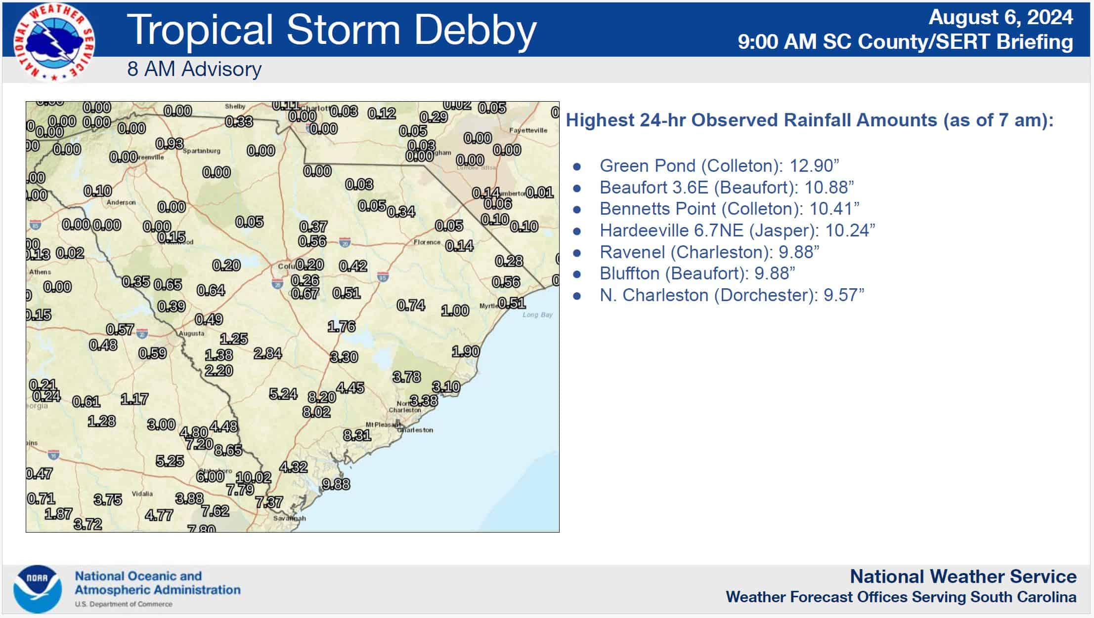
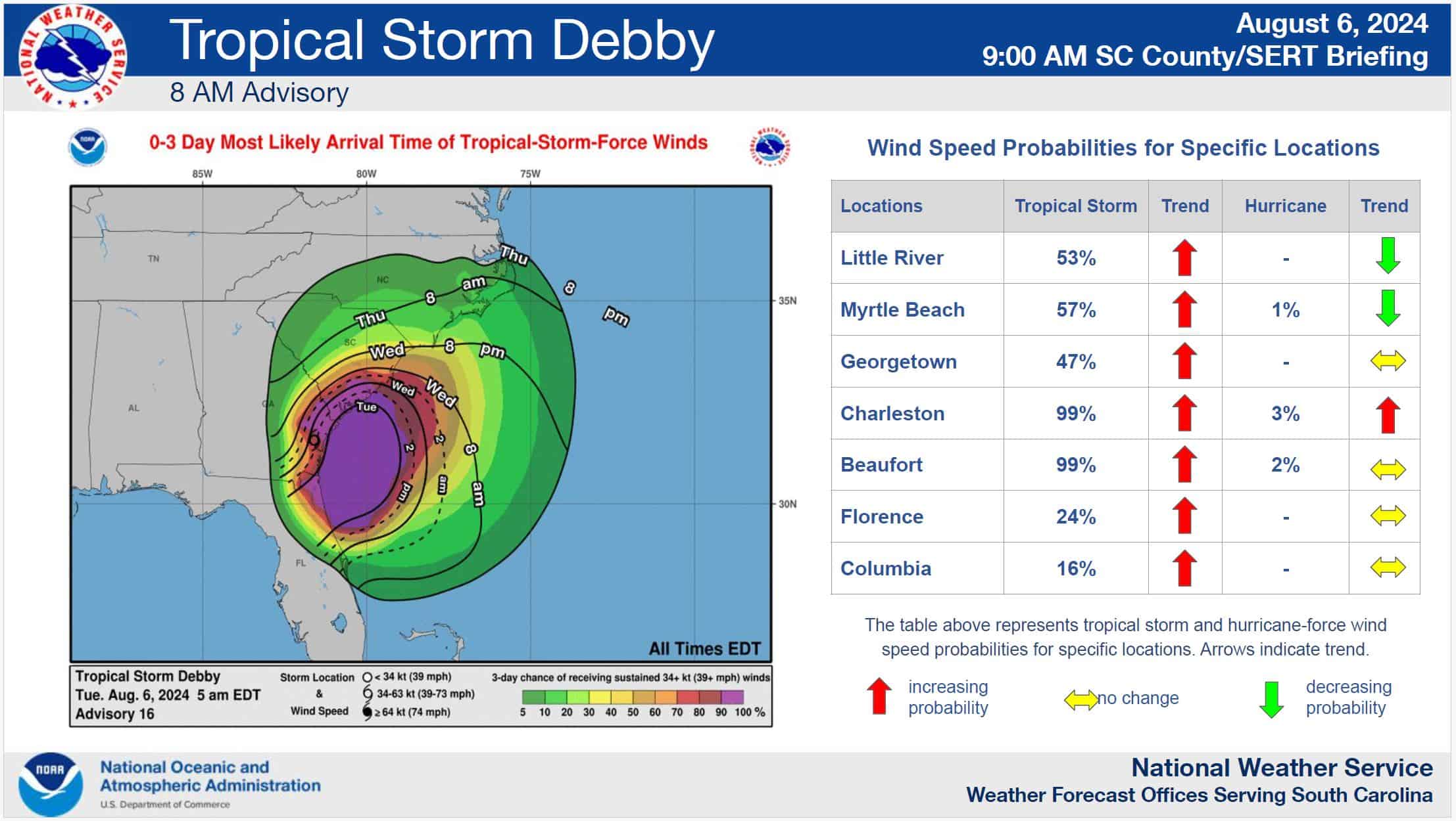
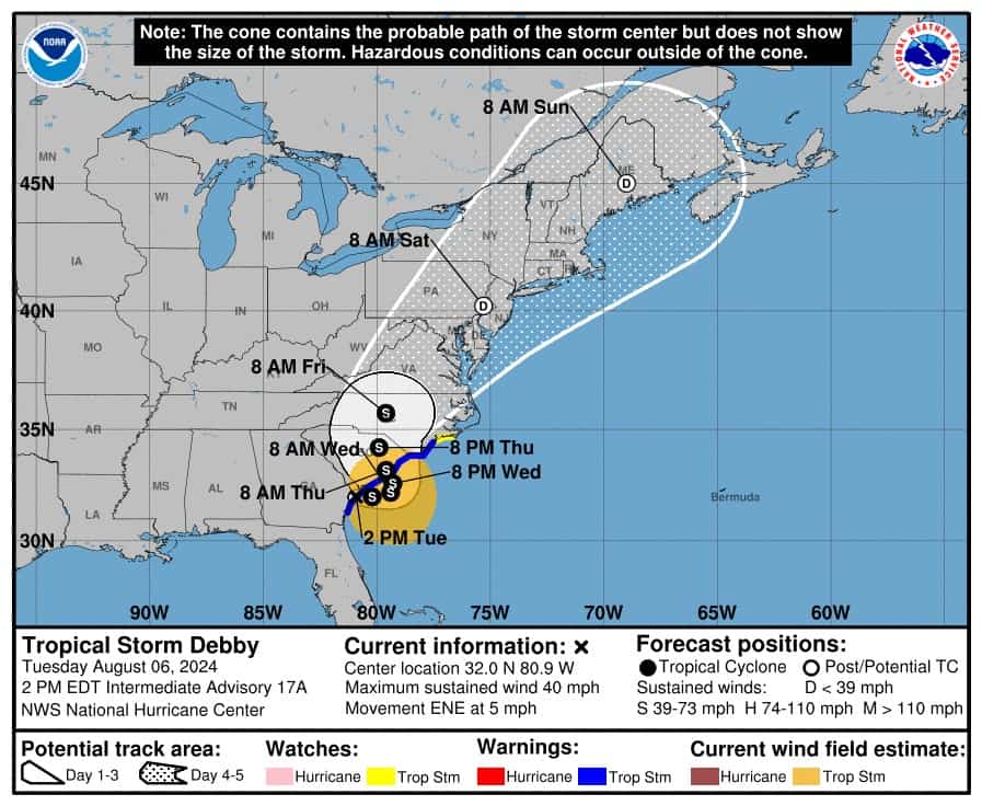
Day two of Debby and most of us woke up to waterfront property that we didn’t want! Nothing much has changed in Debby’s path or expectations. I’ve attached a couple of graphics from the SCEMD call this morning that I thought you may find interesting….the rainfall amounts received by 7 am this morning, the timeline for the expected winds, and the storm tracker.
A couple of good for-the-cause notes:
- They are forecasting an additional 10” of rain and sustained winds of 39+mph possible between now and Thursday.
- The offices were dry last night but the pond we gained in the back lot was impressive. Please keep your wake to a minimum so water doesn’t rush into the shop or garage.
- No plans to open a call center or close the office at this time. Phones will be transferred to CRC this afternoon just as they always are. This will be reassessed early tomorrow (Wed.).
- The only areas evacuated in Colleton County at this time are around the McGrady Dam area of Cane Branch Road.
- There are no shelters open at this time in Colleton County. Surrounding counties have some open. Click Here to view those.
- Should the county decide to enact a curfew, download the reentry form for the cooperative below. Should these measures be put into play, printed copies will be provided for you to place in your vehicle. Showing this email attachment to law enforcement in the interim should suffice.
Great job to operations today and leading up to today for minimal outages and a quick recovery. If anyone has pictures they would like to share of damages or crews in the field please send them my way.
Get some rest this evening and stay safe!


