


Experience savings on restaurants, golf, shopping, travel, family fun, automotive, movies, insurance… everything you can imagine is here. Co-op Connections has the best deals all in one place.
Hurricane Safety
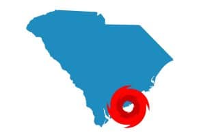 Hurricanes are a destructive natural phenomenon that occurs about 40 to 50 times worldwide each year. Hurricane season takes place in the Atlantic, Caribbean, Gulf of Mexico, and Central Pacific from June 1 to November 30.
Hurricane damage results from three primary causes:
Storm Surge: Approximately 90% of all hurricane deaths can be attributed to the storm surge, the dome of water created by the low-pressure center of a hurricane. This storm surge quickly floods low-lying coastal areas with anywhere from 3 feet for a category one storm to over 19 feet for a category five storm.
Wind Damage: The strong, at least 74 mph winds of a hurricane can cause widespread destruction far inland of coastal areas, destroying homes, buildings and infrastructure.
Freshwater Flooding: Hurricanes are huge tropical storms and dump many inches of rain over a widespread area in a short period of time. This water can engorge rivers and streams, causing hurricane-induced flooding.
What We Do to Help
Coastal Electric Cooperative continually monitors weather conditions and prepares in advance when inclement weather is forecast. We suggest you follow these tips to stay safe during a hurricane:
- Identify where you could go if you are told to evacuate. Choose several places — a friend’s home in another town, a motel, or a shelter.
- Write down instructions on how to turn off electricity, gas, and water if authorities advise you to do so. (You’ll need a professional to turn natural gas service back on.)
- To prevent damage to windows from high winds, install hurricane shutters or purchase pre-cut outdoor plywood boards. Install anchors for the plywood and pre-drill holes in the plywood so it can be installed quickly.
- Make trees more wind resistant by removing diseased and damaged limbs, then strategically removing branches so wind can blow through.
- Secure outdoor furniture, decorations or ornaments, trash cans, hanging plants, and anything else the wind can pick up.
- If you are not advised to evacuate, stay indoors, away from windows.
- Be aware that the calm “eye” is deceptive; the storm is not over. The worst part of the storm will happen once the eye passes over and the winds blow from the opposite direction. Trees, shrubs, buildings, and other objects damaged by the first winds can be broken or destroyed by the second winds.
- Be alert for tornadoes. Tornadoes can happen during a hurricane and after it passes over. Remain indoors, in the center of your home, in a closet or bathroom without windows.
- Stay away from flood waters. If you come upon a flooded road, turn around and go another way. If you are caught on a flooded road and waters are rising rapidly around you, get out of the car and climb to higher ground.
Hurricane WATCH vs. Hurricane WARNING
A WATCH means hurricane conditions are possible in the specified area of the watch, usually within 36 hours.
A WARNING means hurricane conditions are expected in the specified area of the warning, usually within 24 hours.
Be prepared with an Emergency Supply Kit as many services may not be available during or after the storm.

The Saffir-Simpson Hurricane Wind Scale is a 1 to 5 rating based only on a hurricane’s maximum sustained wind speed. This scale does not take into account other potentially deadly hazards such as storm surges, rainfall flooding, and tornadoes.
Category 1: 74–95 mph
64–82 kt
119–153 km/h
Very dangerous winds will produce some damage: Well-constructed frame homes could have damage to roofs, shingles, vinyl siding, and gutters. Large branches of trees will snap and shallowly rooted trees may be toppled. Extensive damage to power lines and poles likely will result in power outages that could last a few to several days.
Category 2: 96–110 mph
83–95 kt
154–177 km/h
Extremely dangerous winds will cause extensive damage: Well-constructed frame homes could sustain major roof and siding damage. Many shallowly rooted trees will be snapped or uprooted and block numerous roads. Near-total power loss is expected with outages that could last from several days to weeks.
Category 3: 111–129 mph
96–112 kt
178–208 km/h
Devastating damage will occur: Well-built framed homes may incur major damage or removal of roof decking and gable ends. Many trees will be snapped or uprooted, blocking numerous roads. Electricity and water will be unavailable for several days to weeks after the storm passes.
Category 4: 130–156 mph
113–136 kt
209–251 km/h
Catastrophic damage will occur: Well-built framed homes can sustain severe damage with the loss of most of the roof structure and/or some exterior walls. Most trees will be snapped or uprooted and power poles downed. Fallen trees and power poles will isolate residential areas. Power outages will last weeks to possibly months. Most of the area will be uninhabitable for weeks or months.
Category 5: 157 mph or higher
137 kt or higher
252 km/h or higher
Catastrophic damage will occur: A high percentage of framed homes will be destroyed, with total roof failure and wall collapse. Fallen trees and power poles will isolate residential areas. Power outages will last for weeks to possibly months. Most of the area will be uninhabitable for weeks or months.
Source: nhc.noaa.gov