Good Afternoon All,
Happy Monday and welcome to the week of T.S. Debby! Just a couple of quick notes as we move into what is expected to be a nasty and long week.
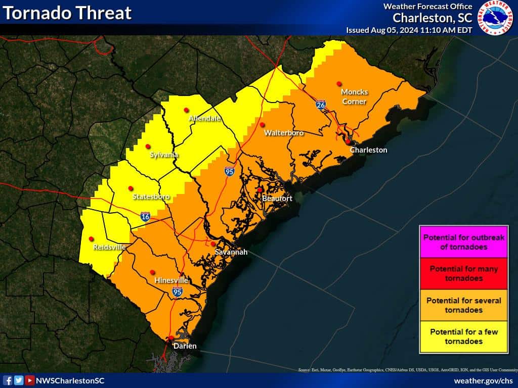
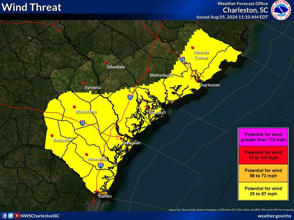
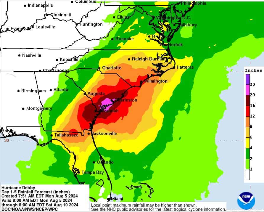
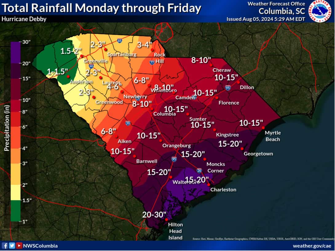
Debby is moving extremely slow. The prolonged period of impact is going to be the key to this storm. She is going to drop historic rainfall through Thursday and bring catastrophic flooding to the low-lying, coastal, and river areas that could be with us well into next week. Along with all of that rain, she is going to bring tropical storm winds that will produce outages. Of course, there is no crystal ball to know what the next few days will bring but this is nothing new for our area and nothing we can’t handle.
A couple of updates for now…
- The linemen will be on standby tomorrow as we prepare for outages that may lead into the night.
- If you have an office that is prone to flooding please make sure that all items are off of the floor before leaving today.
- As we do with any storm, we are having multiple conference calls a day with SCEMD and Statewide to stay informed of any local/state emergency needs and to retain resources if we need them to restore any system damage.
More decisions will be made tomorrow regarding whether storm hours will be implemented and a call center within the front office. We will be monitoring and in standby mode. Everyone please be safe on the roads, take care of your homes and family, and pull out your hip waders!


